Vancouver, British Columbia--(Newsfile Corp. - July 27, 2026) - Medaro Mining Corp. (CSE: MEDA) (OTCID: MEDAF) (FSE: 1ZY) ("Medaro" or the "Company") is pleased to announce the completion of its 2026 airborne geophysical survey and Phase 1 ground exploration program at the Company's Clay Howells West Rare Earth Element ("REE") Project, located 50 kilometres north-northeast of Kapuskasing, Ontario.
The exploration program integrated high-resolution helicopter-borne magnetic, very low frequency electromagnetic ("VLF-EM"), and radiometric surveys with systematic geological mapping, prospecting, ground radiometric surveys, and rock and soil geochemical sampling. The combined datasets will be used to refine exploration targets and prioritize areas for follow-up exploration.
Airborne Survey Successfully Completed
The Company has received the final report from Geo Data Solutions GDS Inc. for the airborne geophysical survey conducted over the Clay Howells East and Clay Howells West claim blocks.
Survey highlights include:
- Completion of 1,143 line-kilometres of helicopter-borne magnetic, VLF-EM and radiometric surveying over the two project blocks.
- Acquisition of magnetic, VLF-EM and radiometric datasets to support structural interpretation.
- Survey coverage completed at 50-metre traverse line spacing with 350-metre tie lines, providing detailed geophysical coverage.
- Average helicopter terrain clearance of approximately 36 metres to support enhanced data resolution.
- Acquisition of magnetic, VLF-EM and radiometric datasets to support structural interpretation, geological l mapping and the identification of radiometric anomalies.
- Processing of the datasets, including residual magnetic intensity, first vertical derivative, VLF-EM conductivity products, and potassium, uranium and thorium radiometric maps, which will be integrated with geological and geochemical information to assist in generating and prioritizing areas for follow-up exploration, including potential drill targets.
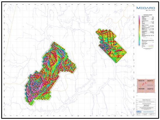
Figure 1: Airborne survey map - first vertical derivative of the magnetic field
To view an enhanced version of this graphic, please visit:
https://images.newsfilecorp.com/files/8279/306597_medaro.jpg
Ground Exploration Program Highlights
- Successfully completed geological mapping, prospecting and ground radiometric surveys across priority target areas.
- Collected a total of 61 rock samples and 45 soil samples from multiple areas of the property.
- All samples have been submitted to Activation Laboratories Ltd. ("ActLabs") in Timmins, Ontario, for multi-element geochemical analysis, including rare earth elements.
- Completed ground verification of historical radiometric anomalies using a Super-Spec RS-125 handheld gamma-ray spectrometer. Scintillometer readings from rock samples generally ranged between 120 and 200 counts per second ("cps"). Several rock samples recorded elevated readings between 200 and 325 cps, while one sample recorded locally elevated readings ranging from 750 to 950 cps.
- Scintillometer measurements represent preliminary field observations only and are not direct measurements of uranium, thorium, rare earth element concentrations or economic mineralization. Laboratory analytical results are required to determine elemental concentrations.
- Rock sampling focused primarily on syenite outcrops, pegmatites and related intrusive rocks, while soil sampling was completed over interpreted geophysical targets.
- Ground access was achieved using ATVs and an Argo all-terrain vehicle, with helicopter support utilized for one day to access areas inaccessible by existing roads or trails.
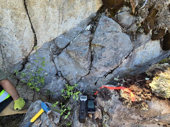
Potassic-altered syenite observed during field mapping
To view an enhanced version of this graphic, please visit:
https://images.newsfilecorp.com/files/8279/306597_7fe169c2f41b4ab7_002full.jpg
"The successful completion of both the airborne geophysical survey and the Phase 1 field program represents an important milestone for the Clay Howells West Project," said Mark Carruthers, President and Chief Executive Officer of Medaro Mining. "The high-resolution airborne datasets, combined with geological observations, ground radiometric measurements and geochemical sampling, provide an integrated exploration dataset that will assist in refining exploration targets and planning for the next phase of work, including evaluating the potential for an initial drill program. We look forward to receiving the analytical results from ActLabs and final processed airborne dataset as we continue to advance the Project. The Project remains at an early stage of exploration, and no Mineral Resources have been defined."
Quality Assurance and Quality Control (QA/QC)
Rock samples were collected from representative outcrops based on lithology, alteration, mineralization and structural features. Soil samples were collected from the B-horizon where possible using standard industry procedures. Samples were placed in sealed sample bags, transported under chain of custody by Company personnel and submitted to ActLabs in Timmins, Ontario, an ISO/IEC 17025 accredited laboratory, for multi-element analysis including rare earth elements. Analytical results are pending.
About the Clay Howells West Project
The Clay Howells West Project is located in northern Ontario, approximately 50 kilometres north-northeast of Kapuskasing, within the Clay-Howells alkalic intrusive/carbonatite complex. The project is situated in an area characterized by syenites, carbonatites, massive magnetites, fault-altered breccias and syenite breccias. Historical regional datasets indicate magnetic and radiometric anomalies. Historical exploration in the area can be traced back to the 1950s and was largely focused on magnetic anomalies and nearby occurrences.
The Company cautions that the Project is at an early stage of exploration. References to nearby deposits, historical exploration, regional geology or adjacent mineralization are provided for geological context only and are not necessarily indicative of the mineralization on the Project. Medaro has not verified all historical information referenced in connection with the Project, and such information should not be relied upon.
For additional images from the ground exploration program, please scroll to the bottom the release.
Qualified Person
Afzaal Pirzada, P.Geo., a consultant of the Company and "Qualified Person" for the purposes of National Instrument 43-101 - Standards of Disclosure for Mineral Projects, has reviewed and approved the scientific and technical information contained in this news release.
About Medaro Mining Corp.
Medaro is a mineral exploration company focused on the acquisition and advancement of high-quality mineral projects in Ontario, Quebec and Sweden. The Company's strategy is to build shareholder value through systematic exploration, disciplined project evaluation, and responsible development.
For more information, investors should contact info@medaromining.com, visit the Company's website at www.medaromining.com, call 1 (604) 800 0203, or review the Company's public filings available at www.sedarplus.ca.
On Behalf of the Company
"signed"
Neither the Canadian Securities Exchange ("CSE") nor its Regulation Services Provider (as that term is defined in the policies of the CSE) accepts responsibility for the adequacy or accuracy of this release.
Cautionary Note Regarding Forward-Looking Statements
This news release contains forward-looking statements and forward-looking information (collectively, "forward-looking statements") within the meaning of applicable Canadian securities laws. Forward-looking statements in this news release include, but are not limited to, statements regarding: the scope, timing, sequencing and expected commencement of the Phase 1 exploration program at the Clay Howells West REE Project; the desktop study, radiometric survey, geological mapping, prospecting, rock sampling, soil sampling, laboratory analysis, data integration and interpretation activities; the anticipated objectives and deliverables of the Phase 1 program; the identification, delineation, ranking and follow-up of exploration targets; the possible advancement of the Project through future exploration phases; and the Company's broader plans and expectations regarding the Project.
Forward-looking statements are based on management's current beliefs, expectations and assumptions as of the date of this news release, including, without limitation, assumptions that field conditions, weather, access, contractor availability, equipment availability, analytical services, and other logistics will be available on reasonable timelines and consistent with current expectations; that the Company will have sufficient financing or working capital to carry out the planned program; and that exploration activities and results will support continued advancement of the Project.
Forward-looking statements involve known and unknown risks, uncertainties and other factors that may cause actual results, performance or achievements to differ materially from those expressed or implied by such forward-looking statements. Such risks and uncertainties include, without limitation: adverse weather, terrain or access conditions; delays in mobilization or commencement of fieldwork; changes to the scope, timing or cost of the exploration program; the availability and performance of contractors, laboratories, equipment and supplies; risks inherent in mineral exploration, including that exploration results may not be indicative of mineralization or may not support further work; geological interpretation risks; sampling and analytical risks; the possibility that the Project may not advance as anticipated; financing and market conditions; and other risks disclosed in the Company's public filings.
Although the Company believes that the assumptions and expectations reflected in the forward-looking statements are reasonable as of the date hereof, there can be no assurance that such statements will prove to be accurate, and actual results and future events may differ materially from those anticipated in such statements. Readers should not place undue reliance on forward-looking statements. Except as required by applicable securities laws, the Company undertakes no obligation to update or revise any forward-looking statements, whether as a result of new information, future events or otherwise.
Fieldwork Photos:
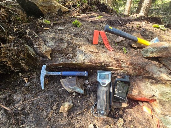
Syenite outcrop exhibiting elevated field radiometric response
To view an enhanced version of this graphic, please visit:
https://images.newsfilecorp.com/files/8279/306597_7fe169c2f41b4ab7_003full.jpg
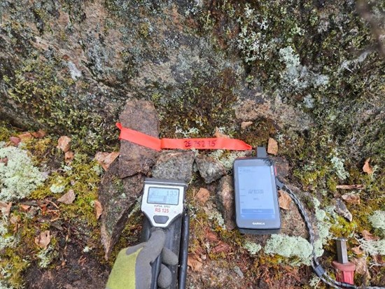
Contact of syenite with finitized dyke
To view an enhanced version of this graphic, please visit:
https://images.newsfilecorp.com/files/8279/306597_7fe169c2f41b4ab7_004full.jpg
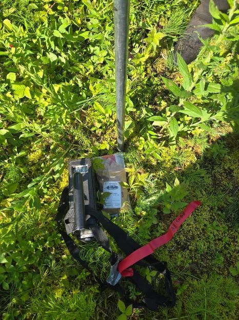
Soil sampling
To view an enhanced version of this graphic, please visit:
https://images.newsfilecorp.com/files/8279/306597_7fe169c2f41b4ab7_005full.jpg

To view the source version of this press release, please visit https://www.newsfilecorp.com/release/306597

© 2026 Canjex Publishing Ltd. All rights reserved.